Remains of San Luis Castle in Estepona
The archaeological remains of a sixteenth-century coastal fortress, recovered and opened to the public beneath Estepona's old town, with an interior walkway and original artefacts on display.
Period
16th century
Location
Old town
Protection
Protected heritage
Today
Recovered site
How it got here
A fortress with several lives
- 1
15th century (local tradition)
Local tradition places an early defensive enclosure here, raised after the Christian conquest of Estepona in 1457.
- 2
Last quarter of the 16th century
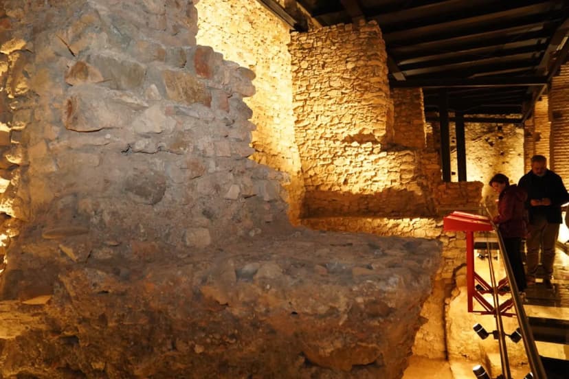
After the 1568 Morisco rebellion, the Crown reorganised the defence of the western Málaga coast. Research points to the master builder Juan Ambrosio Malgrá as the designer of the bastioned layout: three artillery bastions and a large arcaded parade ground, built to watch over the natural anchorage of Playa de la Rada.
- 3
17th to 19th centuries
Earthquakes, wars and the town's own growth damaged and gradually hid the fortress, which was progressively absorbed by the houses of the old town.
- 4
Heritage protection
Like the rest of Spain's castles, it carries generic protection under the Decree of 22 April 1949, reinforced by the 1985 Spanish Historical Heritage Act.
- 5
2024 — Recovery and public opening
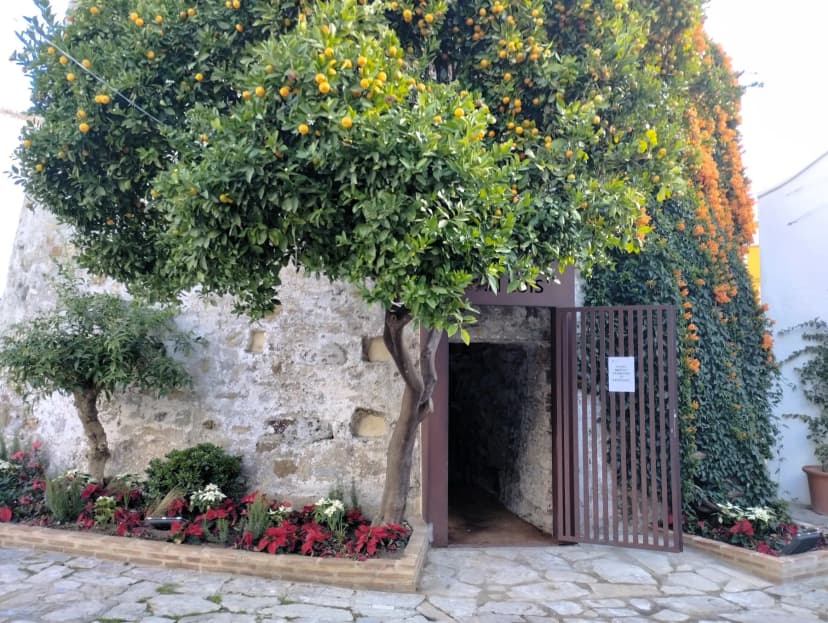
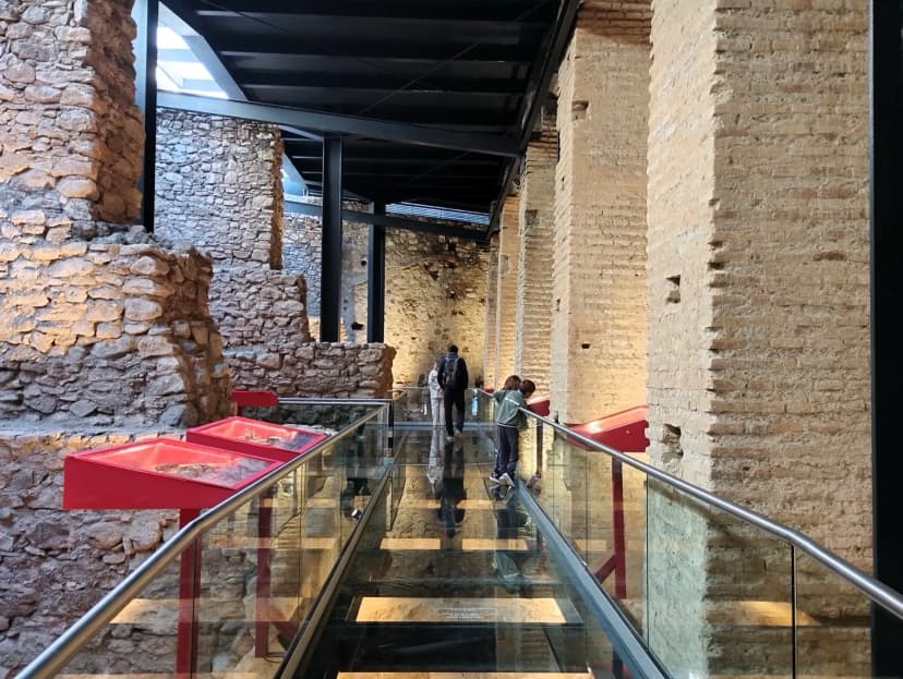
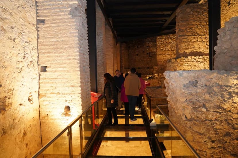
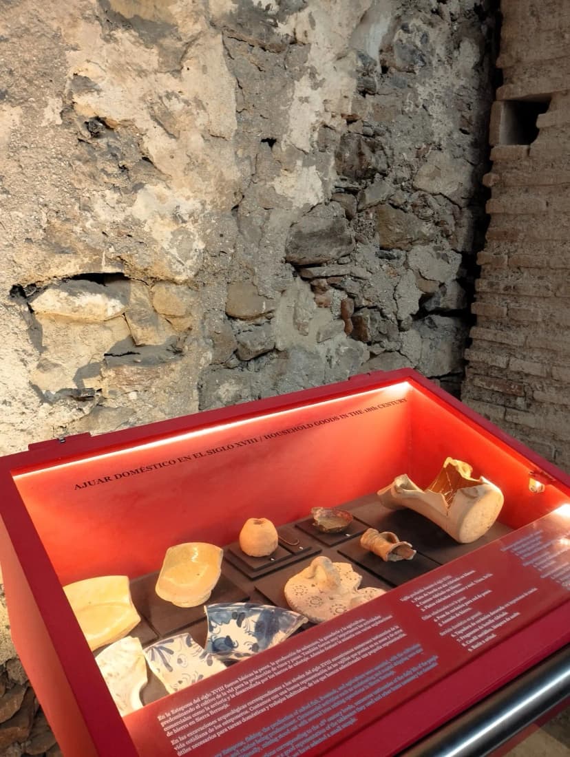
An archaeological excavation and restoration project recovered part of the site: it can now be visited via an interior walkway, with original pieces on display in glass cases.
What survives today
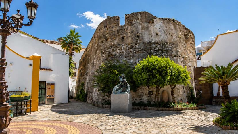
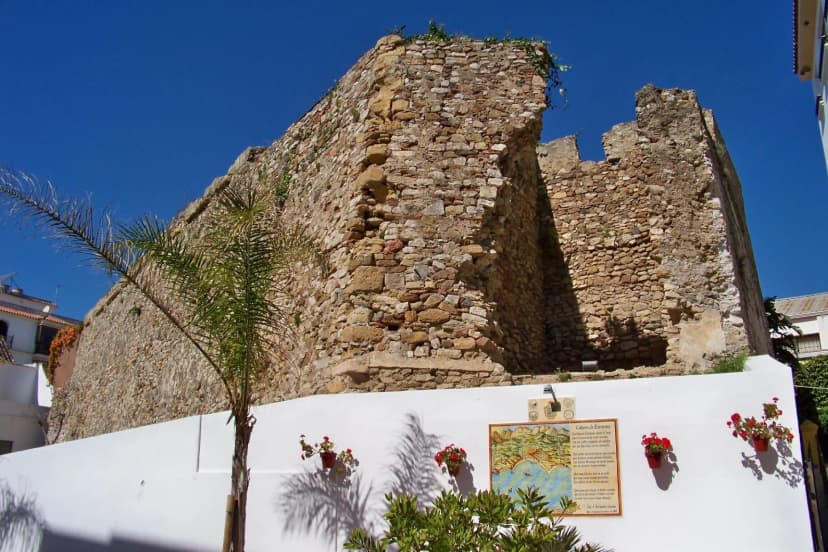
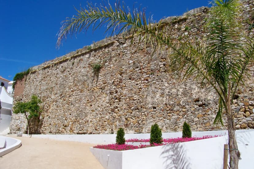
A stretch of the outer wall is visible today, woven into the fabric of the old town, along with an interior exhibition space reached by a raised walkway, with interpretive panels and original archaeological pieces displayed in glass cases. This is not a complete castle, nor a reconstruction: it is a recovered archaeological site.
Opening hours
Monday to Sunday, 10:00–14:00 and 16:30–20:00.
Price
€1 general admission · Free for residents of Estepona.
The interior is visited via a raised walkway; access is not adapted for reduced mobility.
About this place
The name Castillo de San Luis is not documented before 1575. That is what the most recent municipal archaeological study of the site establishes (Navarro Luengo, Suárez Bedmar and Martín Parrado, FORTMED 2020): after the Castilian conquest of 1456 the town was destroyed, and it was not resettled until 1502. Between 1503 and 1504 the walls of the old Muslim alcazaba were rebuilt, but that medieval fortress — already obsolete against sixteenth-century siege techniques — did not yet carry that name. The Castillo de San Luis as it is known today was born in 1575 as a new bastioned front added to the alcazaba's southern wall, the Crown's response to the 1568 Morisco rebellion: three artillery bastions and a large arcaded parade ground, built to protect the natural anchorage of Playa de la Rada. The works, promoted by captain general Fernando Hurtado de Mendoza, were completed in 1588. Over the centuries, the 1755 Lisbon earthquake and the mines French troops planted in its four corners as they withdrew from the town in 1812 left the fortress largely in ruins; only the gun battery survived, incorporated into a house built in the late nineteenth century and demolished in 1994 to open a square. The remains, hidden beneath it, lay abandoned until a careful archaeological excavation and recovery project, completed in 2024, opened them to the public: an interior walkway now lets visitors follow its different building phases and see, in display cases, some of the pieces found during the works.
Tags
Getting there
Calle Villa - Plaza Cañada, Estepona (casco histórico)
Opening hours
Monday to Sunday, 10:00–14:00 and 16:30–20:00.
Price
€1 general admission · Free for residents of Estepona.
Location
Where Remains of San Luis Castle in Estepona is
Sources & credits
Information verified against the official listing by Turismo de Estepona and Estepona Town Council. Photographs: Source: Turismo de Estepona / Estepona Town Council.
Living history
To understand this place better.
Every corner of Estepona carries a story. These articles tell the stories behind this place.
Defensive heritage · Siglo IX – XVII
Castles and towers: a coast always on watch
For centuries, Estepona had a defensive system of two castles and seven coastal towers. Castillo el Nicio, of Arab origin from the 9th century, dominated the interior from Padrón Alto. Castillo de San Luis, from the 16th century, stood in the town centre. The seven watchtowers watched over 21 kilometres of coastline. Three layers of defence on the same territory.
Read the articleCoastal history · Siglo XVI – XVII
Seven watchtowers on permanent alert
From the 16th century, Estepona's coast was defended by a system of seven watchtowers that warned of Barbary corsair attacks. They still stand today, spread across 21 kilometres of coastline, and are one of the most singular pieces of heritage in the region.
Read the articleDigital memory · Año 2000
What InfoEstepona documented in the year 2000
InfoEstepona was Estepona's official tourism website in 2000, created by SIMA with the council's Tourism Office. Over 1,000 HTML files documented the whole city: history, folklore, gastronomy, nature and a practical guide for the international visitor of that moment.
Read the article